
Chinese Navy Seems To Be Preparing To Counter Indian Submarines With Pakistani Help

Satellite images accessed by ThePrint suggest Chinese Navy conducted joint exercises with its Pakistani counterpart; has increased activities around India.
New Delhi: There has been a sharp rise in Chinese naval activity to map the Indian Ocean region, with survey vessels being observed even in the company of Pakistani warships at times, satellite images accessed by ThePrint suggest.
These activities around India indicate possible preparations for anti-submarine operations.
In the past year, the Chinese People’s Liberation Army Navy or PLAN has been sending a large number of oceanographic survey ships to the Indian Ocean region. Besides, Chinese warships and nuclear submarines have been making port calls in Colombo for the past three years.
In February 2016, a PLAN Type 926 submarine tender was seen in Colombo, suggesting a continuous survey mission. A submarine tender is a type of ship that supports submarines.
The Type 926 submarine search and rescue tender #865 Liugongdao is known to travel along with China’s nuclear submarines. This ship is also the mother-ship of the world’s most advanced rescue submarines — the Type 7103 deep submergence rescue vessel (DSRV). The DSRV can dive up to 600 m and rescue up to 18 personnel from a ‘Kursk’ like incident.
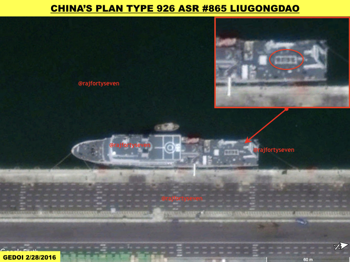
The rescue submarine, however, was not observed on board the mother-ship when it was docked in Colombo. Satellite images accessed by ThePrint suggest that the DSRV was possibly on a special survey mission around Colombo.
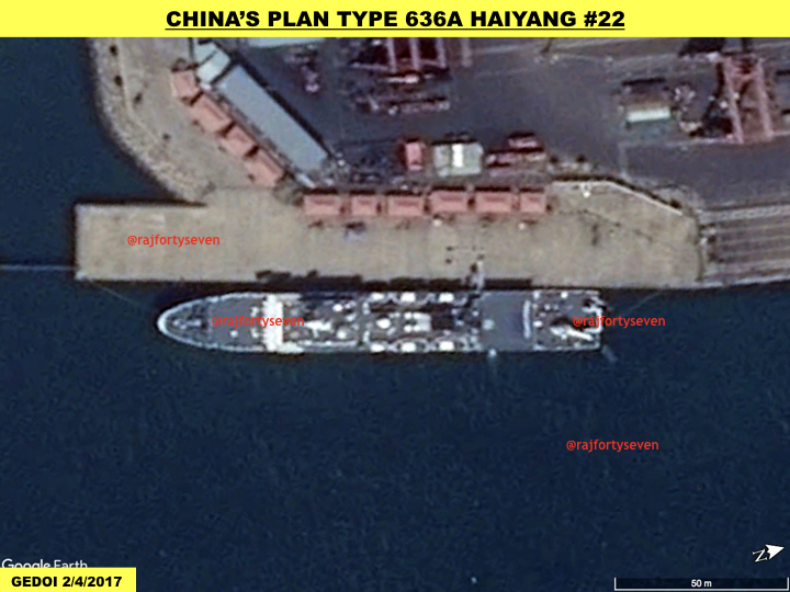
More recently, PLAN’s top naval survey ship — the Type 636A hydrographic survey ship Haiyang #22 class, named after Chinese nuclear physicist Qian Sanqiang — was observed in a satellite image of 4 February 2017. This 130m-long marine comprehensive survey ship with a crew of 134 personnel can endure a journey of 15,000 nautical miles at speeds of 15 knots on its own steam.
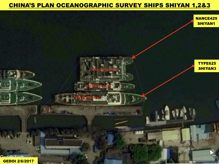
The presence of Haiyang #22 in Colombo clearly indicates Chinese interest in surveying the Indian Ocean region for smoother submarine operations. Earlier this year, China conducted a joint exercise with the Pakistani Navy to survey the Makran Trench in the Persian Gulf–Arabian Sea region. The ship involved is PLAN’s modern Type 625C Shiyan 3 is an oceanographic survey ship.
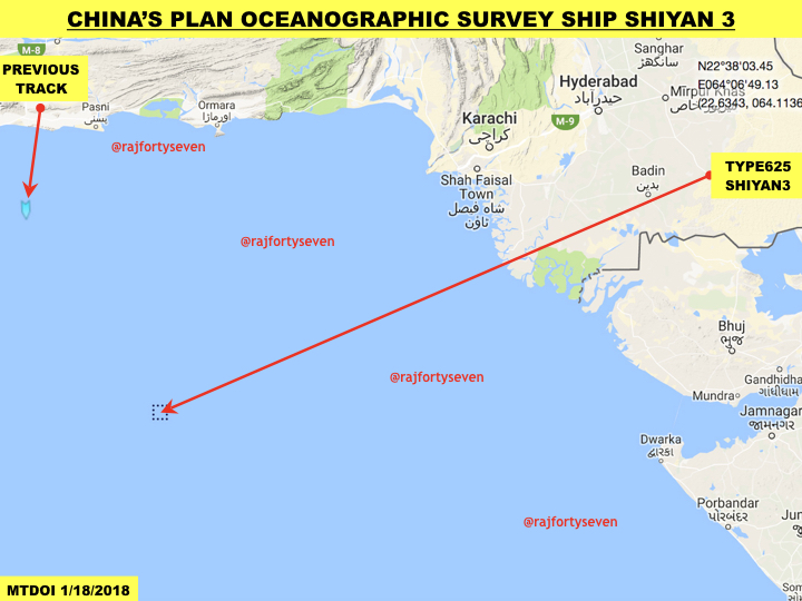
It is surprising that the survey ship was on the west coast of India as of 18 January. The reasons are obvious — Shiyan 3 is conducting underwater surveys of areas in the Arabian Sea on India’s west coast.
The largest oceanographic survey catamaran in the world is undergoing sea trials in China’s Guangzhou. The length is a gigantic 90 m and beam 32 m. The ship is larger than USS Impeccable, which measures 85 m.
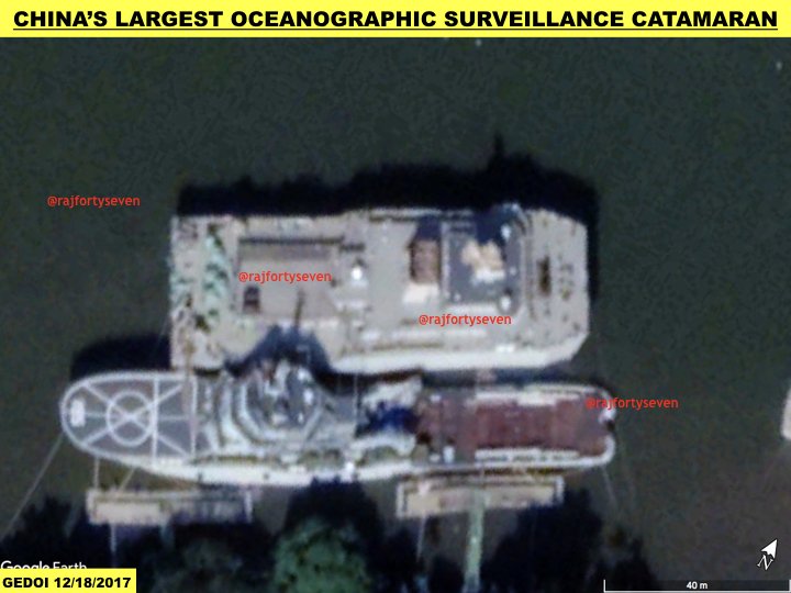
The ship is a small water-plane area twin hull (SWATH) type catamaran and looks very different than its predecessors. It has a humongous funnel at the centre of the ship. This suggests larger engines indicating longer endurance at sea. These ships are supposedly equipped with numerous modern and world-class measurement systems, including submarine geomorphology, submarine surface geological survey, ocean gravity, area temperatures, salinity, density, tide among others.
These ships act as force multipliers in anti-submarine warfare (ASW) for tracking adversaries’ submarines with oceanographic data collected. Their foray into the IOR suggests that China is preparing for an ASW in the region.


No comments:
Post a Comment