
Indian Navy Ship In The Northernmost Atolls For Hydrographic Survey: Maldives Media
The governments of India and Maldives are preparing to launch a joint hydrographic survey in the Maldives. Surveyors will monitor the seas, dry land, reefs, and lagoons under the study.
The survey will commence on January 19 and continue until the 28th of this month on the northern atolls of the Maldives; Haa Alifu, Haa Dhaalu, and Shaviyani atolls.
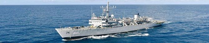
A letter circulated to the atoll and island councils of the north by the Ministry of Defence stated that the Indian navy vessel ‘INS Investigator’ will be used in the survey. It said that the survey will use smaller sea vessels and helicopters for the initiative, and the survey teams will work on a 24-hour basis.
The Surveyors will collect:
- Information on reefs and lagoons- Charting the coastlines of the northern atolls- Installation of tide poles to study ocean currents and tide levels
The hydrographic survey in the Maldives was launched in 2007 as a joint effort with the Indian Naval Hydrographic Office. The survey will be used to update the maps used for GPS, update electronic charts, and create anchorage and approach charts. The survey aims to improve the GPS and navigational charts for transportation and ensure safer travel for vessels operating across Maldivian waters.
The two countries first signed the memorandum of understanding to establish cooperation for hydrographic studies on June 8, 2019, during the official state visit of Indian Prime Minister Narendra Modi to the Maldives.
The first joint hydrographic survey by India and Maldives was conducted between February and March 2021. In 2022, a second survey was conducted in the Maldives' north, as well as the Greater Malé area.
As part of the agreement, the Maldives Hydrographic Service was officially established in March 2022.
Meanwhile, the opposition alleges the initiative was a pretext for India to collect sensitive information or data about the Maldives, and claims it could endanger the national security of the country.
Maldives National Defence Force (MNDF) however refuted these claims and assured the country’s national security will not be compromised. They claimed that the survey was purely to analyse and monitor the reefs and geography of the atolls.


No comments:
Post a Comment